CAIT researcher Dr. Jie Gong presenting his resilience work to state agency employees and decision makers.
Dr. Jie Gong gave a 3-hour course earlier this fall on statewide infrastructure resilience to storms, flooding, and other natural disasters. Much of his recent research has focused on collecting post-disaster data to advance damage assessment methods and resilience by turning that data into actionable knowledge and digital visualization tools. This includes an ongoing FEMA project where he is mapping New Jersey’s 500-Year Flood Plain and infrastructure at risk to future threats.
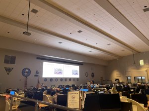
Demonstrating data-visualization tools and innovative technology developed from his latest projects, CAIT researcher Dr. Jie Gong gave a 3-hour training to NJ state and regional agencies on new tools to support coastal resilience planning and better inform flood mitigation strategies.
More than 100 asset owners and decision makers from County Offices of Emergency Management, NJDEP, NJ DCA, and other organizations across NJ were in attendance at the State Regional Intelligence Operation Center this September, to learn about these innovative tools and approaches being developed at Rutgers University and the Center for Advanced Infrastructure and Transportation (CAIT).
“We have developed a suite of software programs for new ways of evaluating and assessing flood impacts to coastal communities,” said Dr. Gong, an Associate Professor in the Department of Civil and Environmental Engineering at Rutgers. “These decision support tools can assist stakeholders at the day-to-day level to protect communities from impending flooding events, as well as in making long-term capital planning decisions in mitigating future flood risks.”
These tools stem from Dr. Gong’s recent research, much of which deals with assessing infrastructure damage following natural disasters. He has led missions after Superstorm Sandy and other storms to deploy LiDAR technology and gather data and images to improve infrastructure resilience and building.
Notably, at the training, results were discussed from an ongoing 2-year Federal Emergency Management Agency (FEMA) grant to characterize the conditions of buildings and infrastructure along New Jersey’s 500-Year Flood Plain.
Through the project, “Terrestrial LiDAR Mapping and Analysis of Buildings and Infrastructures within the New Jersey 500-Year Flood Plain,” researchers have been collecting mobile terrestrial LiDAR and georeferenced street-level digital images along all roadways in the 500-year flood plain in New Jersey. Based on the collected data, the team has been developing digital flood elevation models for at-risk infrastructure.
In part funded by a University Transportation Center (UTC) project, Dr. Gong and his team have also studied the convergence of remote sensing, digital twin, web technologies, and flood simulation for creating an advanced flood preparedness system. This pilot system further materialized into a digital Flood Information Dashboard tool in the previously mentioned FEMA grant. The project used Manville, a frequently flooded township in New Jersey, as an exemplar case.
In addition, after Hurricane Ida hit NJ in September 2021, CAIT researchers took drones, van-based LiDAR systems and other innovative technologies into the field to assess flood damage, gather data to improve flood prediction models, and inform the state of flood risks for future storms.
This research also supported transportation agencies and decision makers in better visualizing floods, and assessing potential risks to their communities and infrastructure, using a digital twin environment.
“This project is the first application of integrating mobile LiDAR-derived city-level data with hydrodynamic models for flood impact visualization and analysis,” Dr. Gong said. “The tools developed are web-based and can be repetitively used in other communities by officials and transportation agencies.”
Overall, he said that the tools and research demonstrated during the course can have a significant impact on coastal city and community planning in the state.
“Training and educating asset owners and decision makers in the state on this innovative technology is an important step toward improving resilience in the region,” Dr Gong said. “With this knowledge, community stakeholders have powerful means to improve flood resilience and safety through more informed planning.”